This year, I nailed it. When I traveled to the ADK last year, my arrival seemed to be a week premature as many of the colors hadn’t yet emerged. By contrast, I was a little concerned when I departed for Wilmington this year that I might be departing a bit too late, but my concerns were quickly laid to rest. There would be an abundance of fall color for me to capture this time around.
Only a week earlier I had planned to stay at the same location that I had the year before in Tupper Lake, but the property owner had a disagreement over a refund that had been awarded to another user by HipCamp and pulled his property off the site in a tantrum. I was left to scramble to find another place that could meet my needs and ended up an hour further to the east in Wilmington, home of Whiteface Mountain.
The change in venue forced me to research trails and locations on short notice. My initial plans had included Saranac 6 climbs and some trails that I was familiar with along Route 3, trying to capture color at locations that had eluded me last year. But by staying in Wilmington, I now had to prepare for a different area with different sights, views, and points of interest. Still, despite my limited time and experience in the area, I found myself excited and confident in the prospects of experiencing a rewarding photo trip.
I took a different route into the ADK region than I am familiar with, traveling east along Route 8 to the Northway, then through Keane Valley (which I AM familiar with). The ride was pleasant and I arrived in the area to setup camp by the early afternoon.
The site was perfect. It was in the backyard of a small home on a short dead-end street only a few 1000 feet from the main road in town, but Wilmington is a quiet community, so there wasn’t any traffic noise. I could only hear the water flowing through the Ausable River.
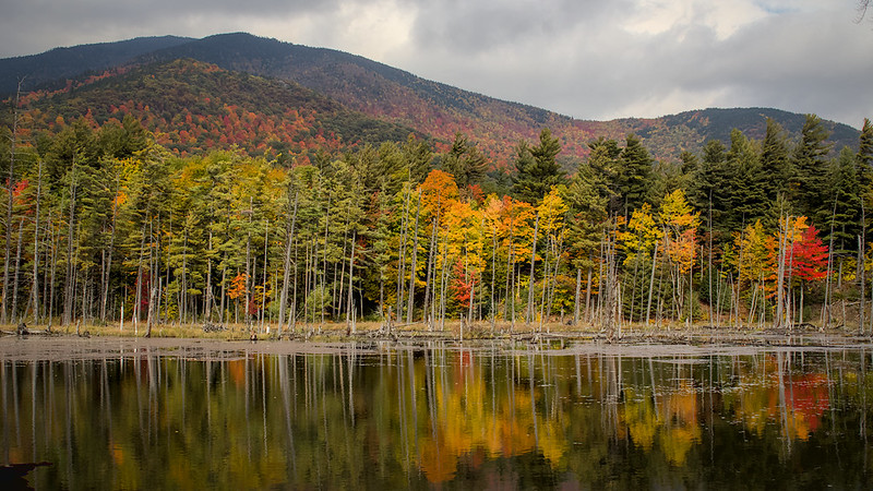
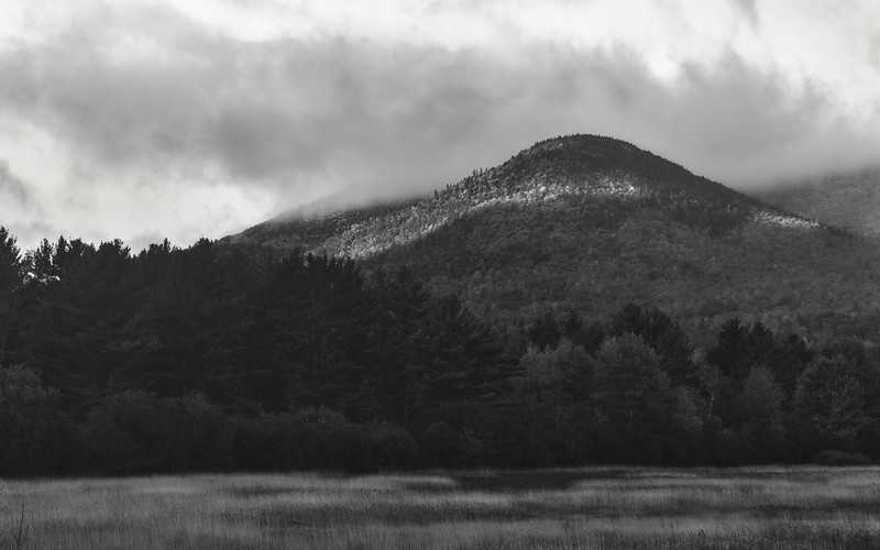
After setting up camp, I traveled south to a small hike I had identified as a nice location to serve as a bit of a warm-up for the weekend: Mount Gilligan. The hike was nice enough at 2.0 miles and a mere 700 feet of elevation gain, but the views are only located at the mid-way point on the trail and the summit itself is not really worthy of the effort. Still, I was able to capture a few images along the way that documented the effort.
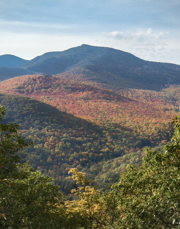
By the time I was coming down from the mountain, the light was fading fast, but I was hoping that there was still a chance to capture the sun falling behind the peaks of the mountains to the west of Keane at the intersection of Rt 73 and 9N. As I was driving to Keane, though, I watched the last light leave the peaks of the mountain tops to the east and I knew I was too late.
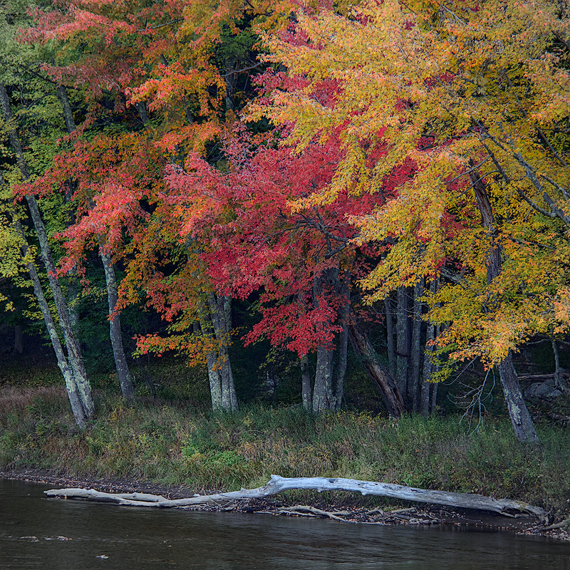
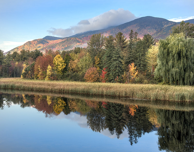
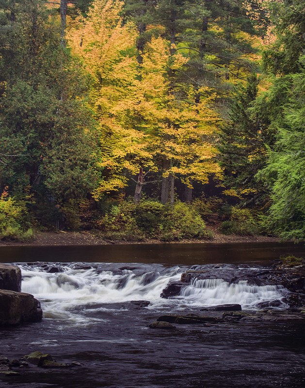
When I arrived back to Keane, the light was failing. I did manage to get out of the car for a little bit to walk along the banks of the river (which was pleasant enough), but the light was gone and there would be no more photography this day.
I would soon be driving into Lake Placid for some whiskey, which I had failed to pack before departing (a mistake not to be made again as I am now keeping a bottle in my waters supply crate), then to camp for dinner and an early rise for more photography.
Well, that was the plan. What I wasn’t expecting was to sleep in after 0700. I hadn’t set an alarm, because, why should I? I sleep poorly in the tent and am usually up at the first sound of the birds. I don’t know if there weren’t any birds (doubtful), if the sound of the river drowned them out, or if I was just exhausted, but (no matter the reason) morning light was not in the cards for me this Friday morning, so I walked to the river to see if I couldn’t capture anything quick and on the cheap before breakfast.
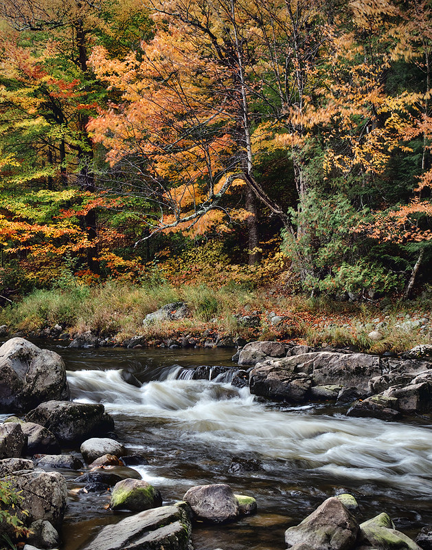
After breakfast, I had plans to drive downstream and walk the western banks of the river. The forecast was for grey skies and rain throughout the day, so hiking any mountains would prove to be silly if I had any intentions of using my camera, but I hoped that the river might prove to be fertile ground for some images.
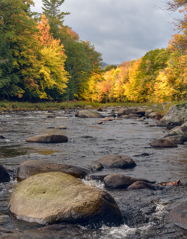
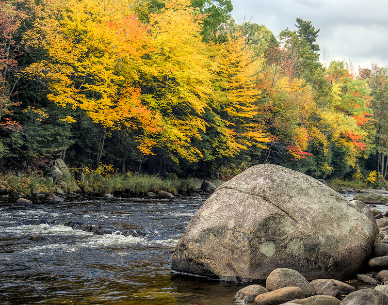
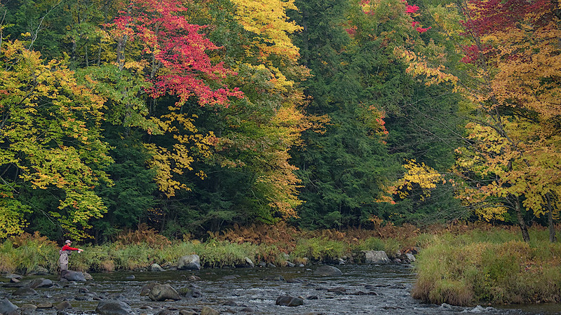
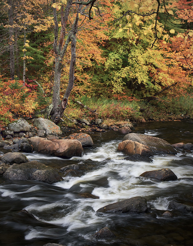
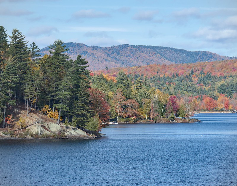
I drove to the parking area for Flume Falls and began a few hours of walking, stopping, photographing, walking, stopping, etc. As I was walking along the river, there was no “hiking”, just walking on level terrain while trying to find sights that would be appealing to my viewfinder.
After the walk on the river, I returned to the car and drove along Route 86 to the trailhead for Winch and Copperas Ponds. The rains were on/off and the light was poor by this time, so a walk in the shelter of the woods to some ponds that may (or may not offer some nice pictures from the shore seemed like a nice-enough idea. And while the idea was a good one, the photographic opportunities at either pond were near nil. I took out the camera only once, if for no other reason than to prove that I had been there.
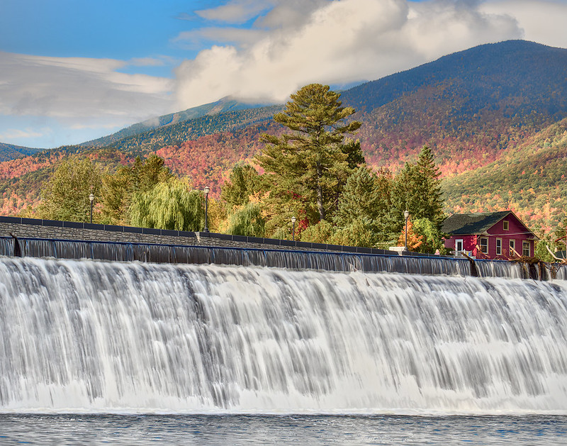
I would spend the remainder of the day driving in the car looking for scenes to capture from convenient locations not too far from pull-offs and parking areas.
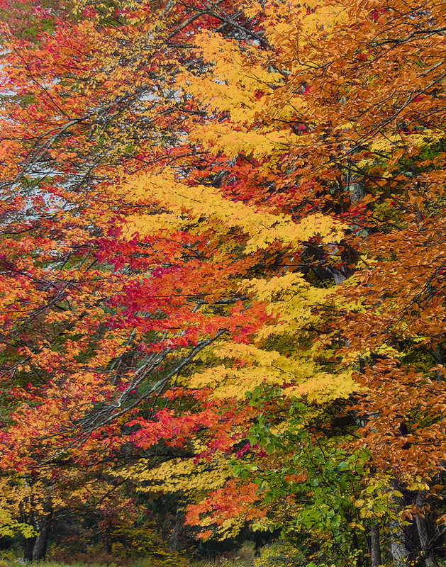
My favorite image of the day was captured west of Monument Falls. It is not a wonderful scene, but it is very nice and it is one of those images that tickles me, because it was captured a bit off the beaten path and I am probably the only person who has a picture that looks like this one.
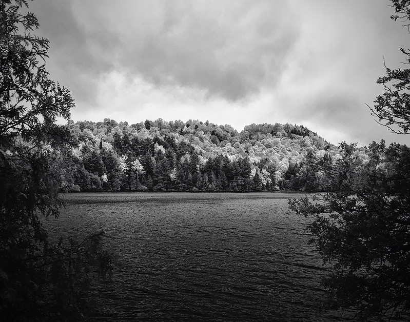
Once I had exhausted most of the possibilities for easy and low effort captures along Route 86, I chose to make a scouting trip to Silver Lake. It was supposed to be an easy, short, and accessible hike that I suspected that I would feel comfortable walking back to my car from even as the light was failing.
The walk was indeed easy and the view was pretty, but I am not sure how to make it photographic as the viewer is positioned up high on an overlook and the there is not opportunity for depth in the scene which reads as very 2 dimensional. It is a scene that needs the conditions to be just right. I am guessing warm water, a cold night, heavy fog, and the sun just peaking over the mountain with a starburst might do the trick. Or some crazy-interesting clouds in place of that sun.
I gotta say, though … I was NOT as happy walking back to the car as I had expected. The light was fading faster than I had expected it to and (at one point) I was off the trail. I looked at my GPS app to try to guide me back to the trail, but I quickly realized that the accuracy and fidelity of the app was not what I needed it to be as I have learned that is can be off by 30-50 feet. 30 feet doesn’t seem like much in the daylight in familiar territory, but when I was hunting for blazes with my headlamp, with no luck, I was getting a bit concerned. The leaf litter was making it very hard to find the trail. Then I stopped for a second and reminded myself that while I was a mile away from the car, in the near-dark, and I couldn’t locate a trail, I still knew where I was. There was a road to the north, a road to the east, and I knew what direction I was traveling in. I would be fine. I might not have been able to find the trail, but I wasn’t lost. After regaining my composure for a moment, I began walking to the east, and wouldn’t you know it … within a couple hundred feet, I came across the trail that I was able to follow all the way back to the car.
My plans for the next morning had been to wake up before dawn and walkout to the Cobble Lookout, located halfway up Whiteface and near the toll for the summit highway. By all accounts, the trail is heavily traveled and well-marked, so I figured I would be able to make my way along the 1 mile trail to the lookout for sunrise. That didn’t happen.
My sleep was very broken this night and I had not difficulties waking at 1630 to get ready for the early morning walk/hike. It was cold and the condensation on the tent had frozen; fortunately I had stayed warm throughout the night. As I was making my way up the mountain I was surprised to be greeted by snow. Only 600-800 feet above my camp, it was snowing. And not only was it snowing, it was accumulating.
When I arrived to the lot, I was one of only 2 cars there. I wasn’t sure what was going on with the other car, but I was not thrilled with the conditions while sitting in mine. I was prepared for the weather, so that wasn’t the issue. I had plenty of layers and would be comfy cozy warm. After the night before, I was a bit concerned about staying on the trail as the snow now covered all surfaces as there was not trail to be seen, only trees. If the blazes were spaced too far apart, I was going to struggle to find my way.
And I did. I tried, but turned around and returned to the car. It just wasn’t worth it. I had the trail on my GPS app, but the accuracy (again) was insufficient for me to stay on the trail and while I wouldn’t freeze if I needed to stay in place and wait for sunlight or other hikers, it would have been a waste of my time to wait that long as well.
Of course, when I returned to the car I discovered a full lot with 8-9 photographers now huddled around the first vehicle. It was immediately clear that someone was holding a workshop and they were all going to the same lookout. I was then posed with 2 choices: (1) wait for them to all walk out 5 minutes ahead of me and follow their foot steps or (2) try something different. As you might have guessed, I chose option #2. I simply didn’t want to stand next to a dozen other people and capture the same image that they did. While it might have been interesting to talk with some other photographers, I also hadn’t paid for the experience and would have struggled to engage in a meaningful way, so it was best to move on.
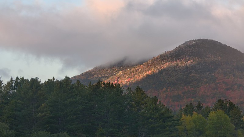
The next best location that I could think of that wouldn’t involve a long walk was Keane, so I hopped in the car and drove to revisit the intersection at routes 86 and 9N to catch the early morning light squeeze beneath the clouds.
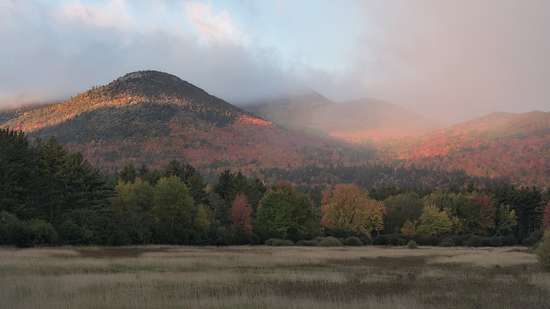
After capturing these images, I quickly drove a couple minutes south to wield the camera from Marcy Field.
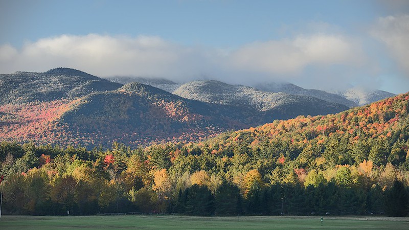
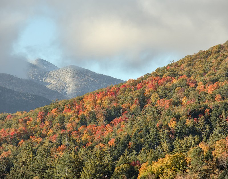
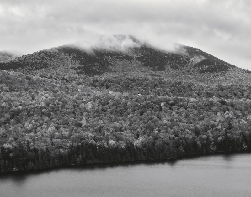
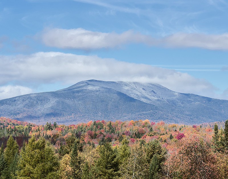
Being pleased with what I already captured, I began to return back to the campsite, but not before stopping back at the same location where I had started and was able to more clearly see the snow covered mountain tops in the distances.
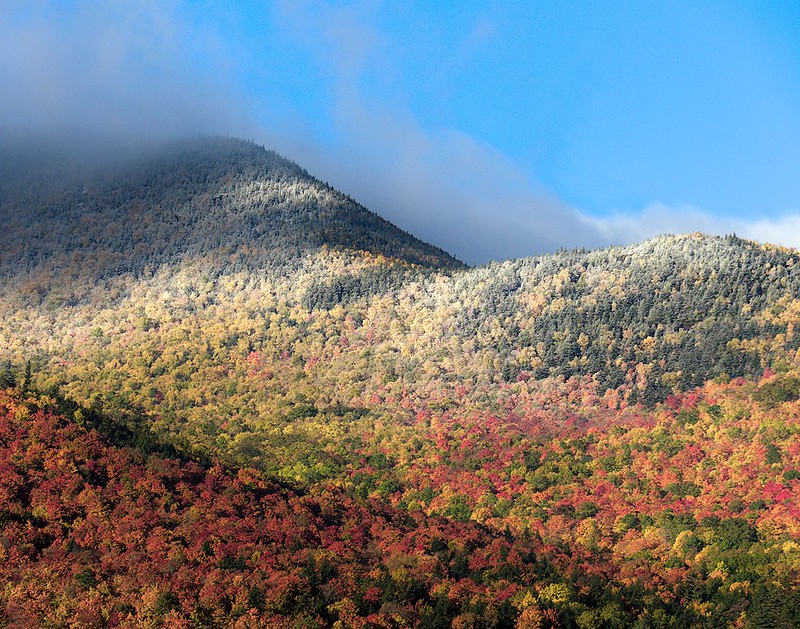
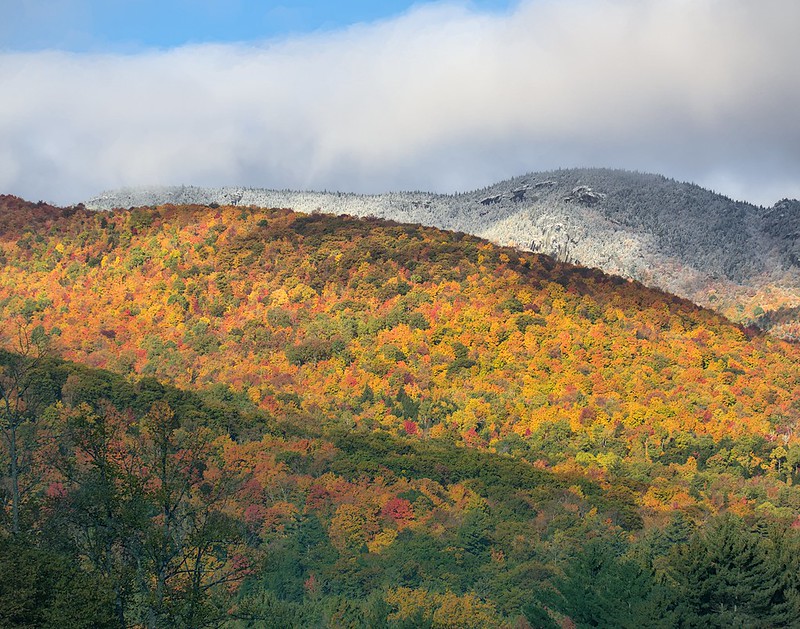
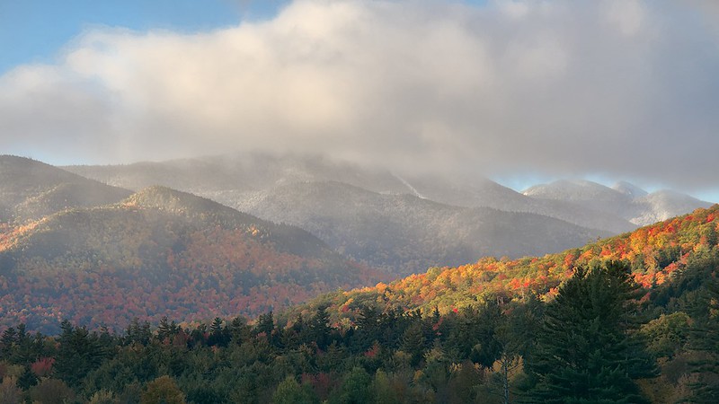
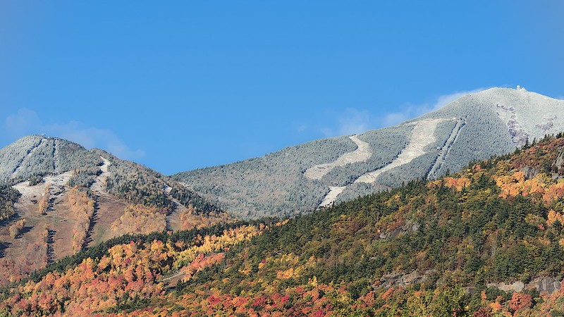
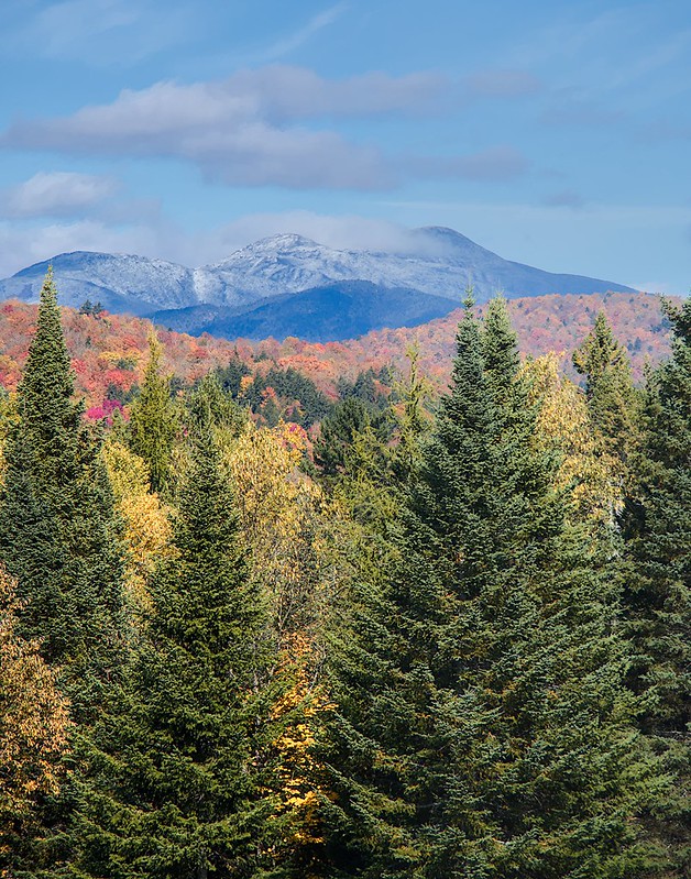
Seeing the snow on these mountains forced me to recognize that I had probably missed a chance to photography similar scenes of Whiteface, which was now 30 minutes away and would be in harsh light by the time arrived. Still, I figured it was probably worth a drive by just to see it.
I was right, it was neat to see. I was also right in that the light was too direct and harsh by the time I arrived to the scene.
After a few snaps, I returned to camp and packed up. I had reservations for another night, but rain was arriving in a few hours and the clouds were going to persist throughout the next day. There was no chance for good light after the afternoon, and I wanted to drive around with the camera on the way home, so I would be leaving after only 2 nights.
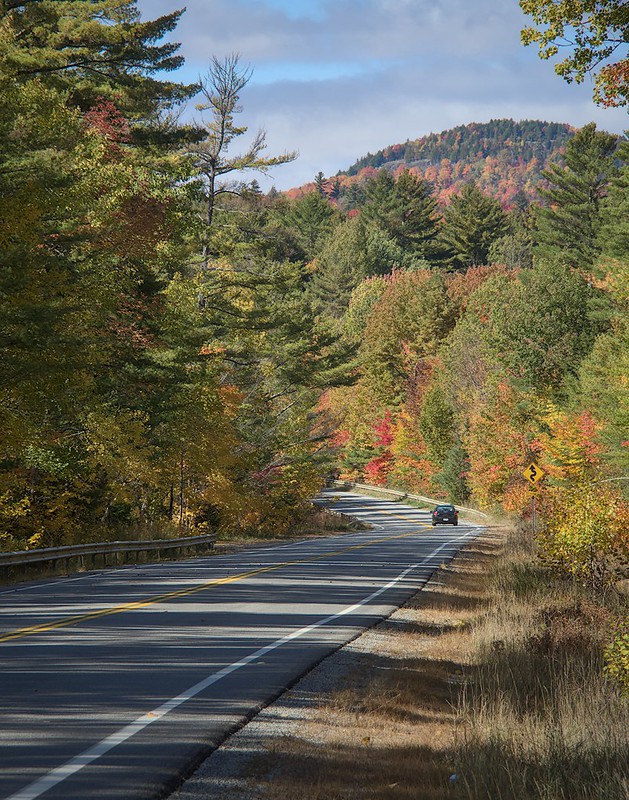
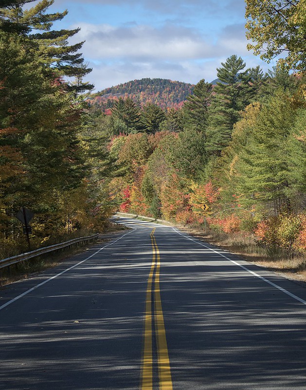
I had to choose between the routes known and unknown to travel home. I could take Route 3 and go back through Saranac Lake and Tupper Lake and make my way to Old Forge, or I could take Route 28 through Indian Lake. I chose the path never traveled and took Route 28. Stopping frequently along the way to capture images when I could.

Overall, it proved to be a successful trip and there are a few images that I really enjoy. I had fun exploring new areas when I wasn’t living in fear of becoming lost. The camping part of these trips is now routine and my setup is effective, but cold weather sleeping still needs a bit of work, I think. Perhaps I need a little more insulation under my pad, but I also think that I might need to move to a solution that allows me to sleep on my side more effectively, because my shoulders/hip become a bit sore when lying on my side and I the mummy bag I use in the cold prevents me from lying on my side as the temps begin to drop anyway. Maybe a hammock setup would suit me better. Time will tell.
In the meantime, I prepare for next week’s trip, this time in the Catskills.