I had looked at the map before leaving the house. I had a pretty good idea of where I needed to go. I’d park in the lot, go east, then take a trail north before continuing east to find the waterfalls. No problem, I thought.
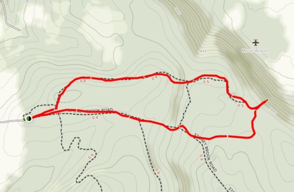
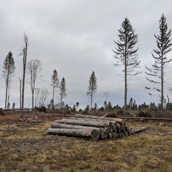
I would proceed down the road, then head north on the trail that would intersect after 0.8 miles. That was my plan. On the way, I would cross the a section of forest that was being thinned on the north side of the road. No check that. It was being harvested.
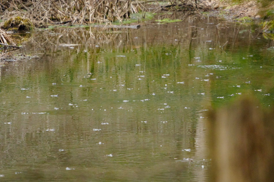
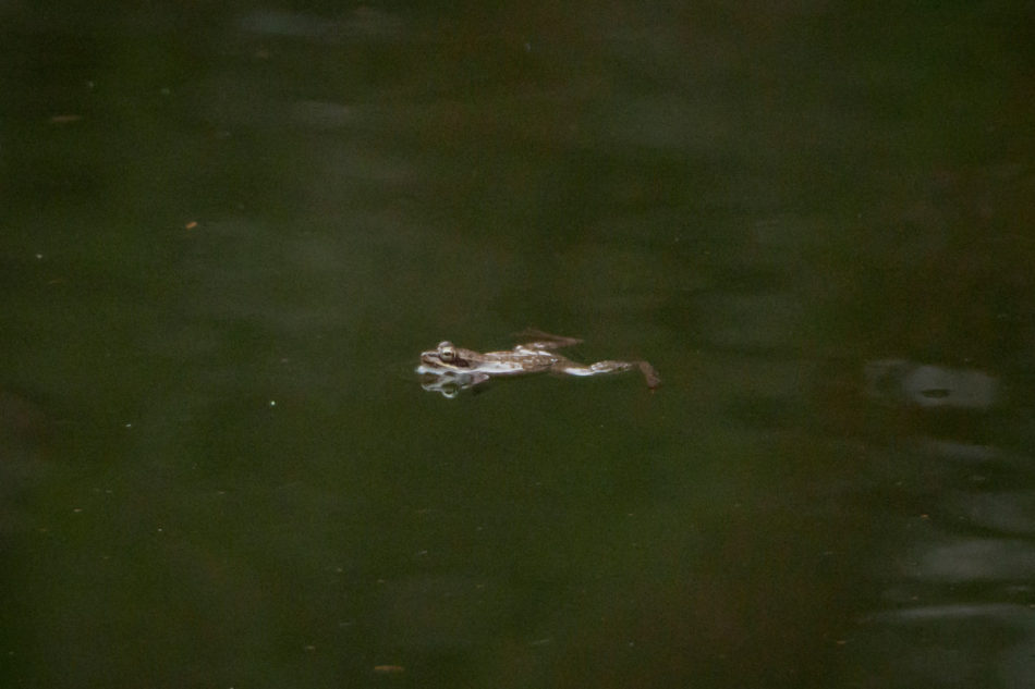
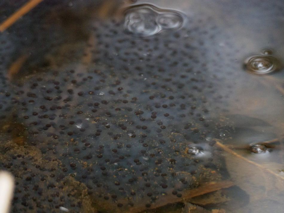
Also on the way, I would hear frogs in the distance; finally I came to a low area filled with water and I could see what the commotion was about. There were thousands of frogs in the woods, and hundreds in the small little piece of water that I photographed here. I think they were mating; I also think that I photographed eggs that will eventually become tadpoles.
I continued down the road and found a trail that I thought was what I was looking for, so I turned north and followed a very wet trail until it came up to posted-private property with a small cabin. I had not crossed any other trails, so I must have traveled north on the wrong trail, I thought. I wasn’t sure how I could have traveled too far north without having crossed the other trail that was to take me to the falls, but I turned around anyway and returned to the road, continuing east.
As I continued along the road began to travel to the south, and I knew that I was headed in the wrong direction. But I came across a small stream that was flowing down from the north, which was the location of the falls, so – in my mind – perhaps if I bush-whacked along the stream, it would lead me to the falls. That lasted for 10 mins before I recognized that this too would end in failure. The “stream” bifurcated. Then it bifurcated again … and I realized this was not going to lead me to anywhere. I turned around and returned to the road.
Defeated, I returned to the parking area and found the trail that would head north immediately and take me along a different path to the falls. There were bright orange blazes to mark the path and they would accompany me all the way to the falls.
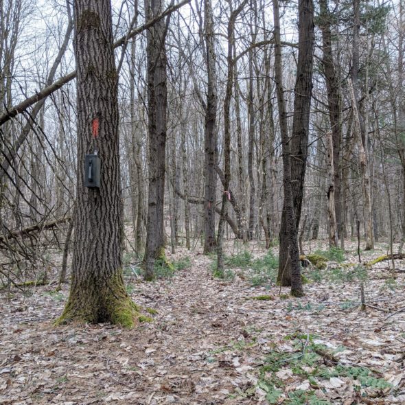
After a short while, the path turned east and I traveled along the back side of the section of trees that had been cleared. After another 5–10 mins I saw the cabin in the distance. “You’ve got to be fucking kidding me,” I thought, “This path is going to go right near where I had been 2 hours ago.”
Not exactly. I actually crossed the path that I had been on earlier, passing just adjacent and to the south of the posted property. The trail had been there all along, but I had been looking for something that had been more traveled and something that was wider. The trail that had turned off the road earlier in the afternoon was wide enough for a large ATV vehicle. I had been looking for the same, not a little-trodden-upon single-track hiking trail. Yet there it was after all.
I still had another half mile to walk, but the adventure was over. The trail would clearly mark my path to the top of the falls.
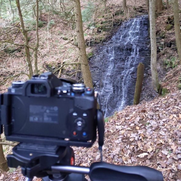
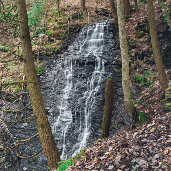
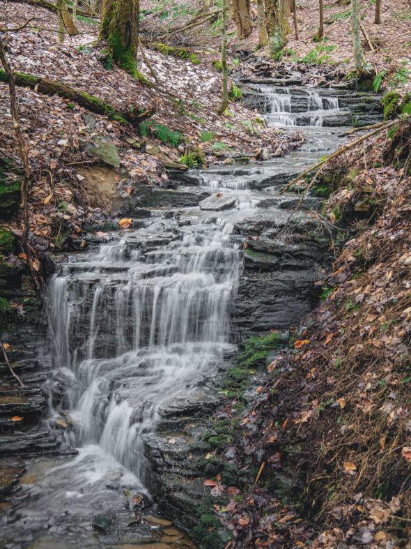
I say “the top of the falls” because it was a long way down, and without a rope the control my descent and offer assistance to go back, it wasn’t worth trying to get to the bottom, which is reportedly a series of cascading falls after this 40-footer. I setup the tripod and captured one photo of the falls…
… and another photo, this one a little further upstream.
Now that I knew where the path from the road crossed the blazed-trail, my walk back to the car was an unremarkable one.
At the end of the day, I had walked 6.5 miles; I had only intended to walk 2.6, but unexpected things happen sometimes … kinda like the last pictures of the day, first captured along the service road in the forest …

… and the second, captured in 4 focus-stacked frames from a field on the way back to the road.

It was an enjoyable afternoon. Still no “portfolio-quality” images, though.